Saturday, July 29, 2017

East MacDonnell Ranges

By Jen.

Turns out there is a lot in the red center to see. However, the majority of it is west and south of Alice Springs, whereas the stuff east of it is pretty even with it. So, we decided to hit up the East MacDonnell Ranges before heading west and south. These scenic ranges are not as popular, especially since it only recently got bitumen on the highway there.

Since it was getting fairly late and it was a weekend, we chose to start off at Trephina Gorge. This put us quite a distance from town (to avoid overnight drinkers) and let us work progressively westward.

That next morning, though, as I cut an apple for breakfast, I managed to fling a knife on the ground and cut myself. This was a first for me. Fortunately, it didn’t really hurt, but it did bleed a lot. I put on my big-girl shoes, stuffed some padding into my shoe (the cut was right where my shoe ties) and went on our planned walks for the day.

DSCN4769
We started off with the Trephina Gorge Walk, which was very scenic that next morning.

DSCN4779Then we received beautiful views from Panorama Walk.

DSCN4789
This is the largest ghost gum tree in Australia.

DSCN4790
It is 33 m tall and over 300 years old!


DSCN4806
It ended in a series of non-traversable ponds that would be a great waterfall in the wet season.

DSCN4812

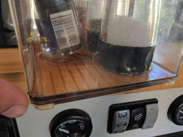
 Upon returning to the van, we were bombarded by a strong sesame-oil fragrance. Turns out that that during the difficult 4WD trip up to the Chain of Ponds walk, the glass bottles of sesame oil and soy sauce bounced at least one time too many against each other and shattered the bottom of the sesame oil. Good thing we keep everything in these containers! Note to self: don’t put glass containers next to each other!


DSCN4815

DSCN4830
From Trephina Gorge, we went to N’Dhala Gorge, where we had the campground to ourselves. The walk the next morning was filled with many petroglyphs. They were located in such bizarre temporary locations (fallen rock, below the waterline).

DSCN4847
This is Corroboree Rock. What is interesting is that it is particularly long and narrow.

DSCN4846

DSCN4856
This Port Lincoln Ringneck and its mate flitted past us at Jessie Gap.

DSCN4864Both Emily and Jessie Gap had rock paintings similar to these. They are related to the emu and caterpillar dreaming stories.

Then, we were back in Alice Springs, ready to head west and south.

Personal Note: By the point we reached Trephina Gorge, my knee was feeling really good again. I had even restarted my cardio and weightlifting exercises. But then, all day at the Trephina Gorge National Park, I walked 8.2 km forgot to put on a brace or tape. I felt fine during those walks, but afterwards my knee was sore and (spoiler alert:) my knee still hurts several weeks later. It feels really strong, but I can’t seem to get rid of the stiffness. I am trying another regimen of anti-inflammatory pills to try and get it under control, but still appreciate your prayers. Oh, and my back rash/fungal infection still hasn’t gone away, so I am going to the doctor again for that.

Wednesday, July 26, 2017

Heading South Again (Temporarily)

By Jen.

Darwin and Ubirr are as far north as we will be in Australia (approx. 12.4° S) unless we decide to go up to the Tip (approx 10.7° S) of Cape York (still in debate currently as it is a long 4WD road). The road leading up to Darwin also connects (via pavement, which is really important) to Alice Springs in the iconic red center of Australia. That combined with the fact that it was the right time (the dry, cool season) of year to visit the center made us decide to head south again to mark that section off our list before resuming our journey across the north of the country. However, to get to the red center requires driving around 1400km south from Darwin. It is in the middle of the Northern Territory, whose population is miniscule, which means cell reception and POIs are few and far between. We made the trip in a few days, with a few stops to break up the monotony.

First stop was Mataranka, where a set of “thermal springs” are the attraction. These actually aren’t springs that are heated by magma (etc). They are simply heated by the surface temperature of the earth’s crust as it is warmed by the sun. The result is a lukewarm water that isn’t too cold to swim in, even in the “winter.” Of course, since it is still in the tropics, the weather was still pretty warm during the day and night. The spring known as Bitter Springs has this beautiful blue-green water because of the calcium and algae growing in it. Elsey National Park had it set up so that you could enter into the stream at one point, then float downstream to another point then walk back to your stuff. We decided to give it a try.

DSCN4707


DSCN4709


DSCN4710


After visiting a few springs and doing a botanical walk in the small national park, we decided to go find a camp spot and call it day. The next day held much less of interest. One of the roadhouses on the way had a small aircraft which had crash landed at some point. We assume it was hauled and deposited there (no sign of wreckage in the area).

DSCN4718

DSCN4719

I found the terrain interesting as we drove along. It was mostly flat, but there were a lot more trees than I was expecting in the “arid desert” center. We had forests and tall trees for about half of the distance to Alice Springs. Then they slowly got shorter and sparser. But even around Alice and such, there were still plenty of trees, tall brush, and grass. A far cry from the sandy desert-like center I had always imagined.

Most notable along this route are the Devil’s Marbles, which are large rounded boulders all in a small area along the highway.

DSCN4726

DSCN4727

DSCN4730

One of the roadhouses along the road was known for its eclectic collection of banknotes, postcards, and memorabilia on the walls. This tradition began as a way to guarantee that you would be able to have a beer when you next come through. A person would right his name on a bank note and pin it to the wall. You can see how it has evolved. We added our own card to the wall.

DSCN4752

DSCN4749

DSCN4750

DSCN4751


Then, right before Alice Springs, there was a town with an aboriginal art gallery and whose position was marked by 2 large statues.

DSCN4753

DSCN4757
This aboriginal man is 17m tall to the tip of his spear and weighs 8 tonnes. The woman is similarly sized.

Not far from there was the highest point on the highway, at a soaring 721m of elevation, after which we descended into the roaring, surprisingly large town of Alice Springs.

DSCN4758


DSCN4759


Fun Note: In the last few days of Western Australia, I decided that I sit too much. In fact, some days, I wasn’t doing any better than when I was working full time at an office job. Many studies are beginning to show that sitting 8 hours or more a day is detrimental to one’s health. So, I decided that I should try to avoid sitting or laying down so much. It has been an interesting process, as I natively don’t stand well. I have hyperextending joints all over my body and my knees extend past vertical a full 10°. I have to focus on not locking my knees and keeping them “bent” (which for a normal person is vertical, but not locked in place). My feet have had to adapt as well (they always complain about me standing on them too much). Interestingly, many of the exercises I do for my knee have also helped my standing posture. All that to say that despite the difficulty, most days I have been able to do it. I am not necessarily more active than I was, I am just doing things standing that before I was doing sitting. For example, standing while blog posting, watching TV, etc. I don’t know that I notice much difference in myself, but I do think it has been a good thing for my knees. I guess time will tell.

Sunday, July 23, 2017

Kakadu

One of the major national parks in NT, Kakadu is one of the largest in the territory.  Known for its rock art, and intact unique biosphere, it is also one of the only two parks in NT which charges an entry fee (exorbitant in my opinion). 

Here is a sampling of the rock art that can be seen in numerous areas throughout the park.  Indigenous peoples have been using these areas for thousands of years.  In many, there are successive layers of rock paintings overlapping each other going back as far as 15,000 years. 

 DSCN4599

DSCN4574

DSCN4575

DSCN4576

DSCN4587

DSCN4662

DSCN4644

DSCN4646

DSCN4654

The views are pretty good too.
DSCN4628

  DSCN4676

DSCN4675

DSCN4681

DSCN4682

DSCN4695

DSCN4705


Wednesday, July 19, 2017

Darwin


Following our visit to Litchfield, we continued north to Darwin, taking the northern exit from the park.  Darwin is a strange confluence of various influences.  The English settlers, Southeast Asian Islanders, and Aboriginal cultures all come together in tropical city with a monsoon climate.  The city has some interesting history, and saw plenty of action during WWII. 

Like most Australian cities, Darwin has well-funded public spaces, and interesting places to visit.  Given the cost of accommodation in any major Australian city and the warm/humid weather, we opted to keep our visit to Darwin on the short side. 

Our first point of interest in the city (after parking near the waterfront) was the WWII fuel storage tunnels.  Built under a short distance from the port, these tunnels were actually enormous underground tanks for storing fuel for military purposes. Originally built to replace above ground tanks (which were bombed by the Japanese) only a few saw service due to their poor design.  At over 200ft long, and 12ft high, they stored huge amounts of fuel.  However, the regular rains saturated the rock above leading to corrosion and leaks, eventually causing a blowout in the 60s in the tank remaining in service.

One tank has been opened for visitors. You can see the water constantly pouring from holes in the steel (even during the dry season!).

DSCN4414

DSCN4419

Here is one of the closed tanks, Even with the drains open, there is still several inches of water.

DSCN4412
After enjoying some time near the waterfront we did a bit of a tour through the downtown area, and around the NT parliament building.  After which we visited the old QANTAS hangar.  Qantas is now a major international airline, but it started out servicing Queensland and NT. 
DSCN4424

Now belonging to a local machine and car club, the hangar is filled with all manner of classic cars, industrial antiques, and steam powered equipment. 

DSCN4421

Bombed during a Japanese raid, the superstructure still has shrapnel holes See the orange spots below.

DSCN4423

There are several very good museums (art etc) as well as plenty of great Asian food available.

After finishing up in the city, we headed south to the Territory Wildlife park.  Basically more of an “open range”-feeling zoo, it has an impressive array of NT animals, including a fairly large saltwater aquarium.  We arrived late in the day, and not wanting to make the trip again (or pay the local rates for accommodation) we opted to take the 2 hours before closing.   There were only 5 people in the park, and we basically had it to ourselves. 

This water monitor (about 3 feet long) was hiding in the water looking for some dinner.

DSCN4427

 DSCN4429

We spotted this mid-sized freshwater crocodile as well (about 4 feet long).

DSCN4432

DSCN4431

A plethora of birds flitted about, including this Rainbow Bee-eater

DSCN4435

A blue winged Kookaburra.

DSCN4501

DSCN4446

DSCN4449

DSCN4487

DSCN4496

DSCN4525

A 4 meter saltwater crocodile.

DSCN4552

DSCN4518

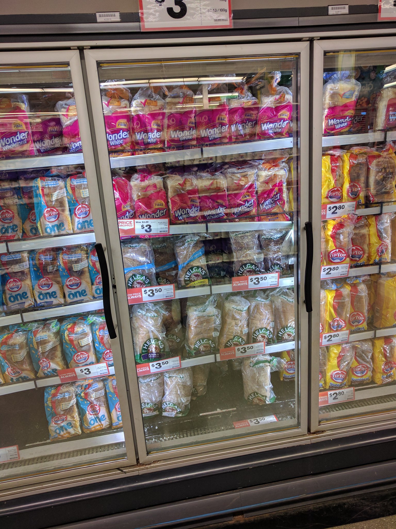
Fun Fact (by Jen): Since about Port Hedland in Western Australia, we have had trouble with our bread molding within days of use and even before the expiration. Perhaps it has something to do with the weather in the northern part of the country or perhaps the time it takes to get to these remote locations. We have had to make room in the fridge for the bread full time. Apparently the stores have this issue as well. All bread in stores since Port Hedland has been in its own freezer section.